Searching for individual animals in the vastness of the world’s oceans is far more difficult than finding the proverbial needle in a haystack. It’s an ongoing challenge for scientists who study marine life such as whales and sea turtles, which routinely travel thousands of miles and spend time in remote, unreachable waters.
The job just got a little easier, however, thanks to two literally out-of-this-world tools: satellite images and a tracking system that uses an antenna on the International Space Station.
Far From Closeups
Scientists recently confirmed that it is possible to locate and identify whales in images from a DigitalGlobe WorldView-3 satellite, which provides the highest resolution currently available.
“We looked at four species that are fairly different in color, shape and size and were pleased to see that we could detect their flukes and flippers,” said Hannah Cubaynes of the British Antarctic Survey at the University of Cambridge. “That showed us that we can see whales in the satellite images and differentiate between species, so we can use satellite images as a reliable method to study the animals.”

Observing the animals where groups of them are known to gather, the researchers focused on southern right whales off the coast of Argentina, humpback whales in the Hawaiian Islands, fin whales in the Pelagos Sanctuary in the Mediterranean Sea and gray whales off the Pacific coast of Baja California.
“We were pretty sure that each of those species — and just that species — would be in those locations at the time,” Cubaynes said. Behavior and differences in body structure make some whale species more distinguishable than others, she added. Fin and gray whales are easy to pick out, for example, because their body color contrasts with the surrounding water, and they often position themselves parallel to the sea surface. Southern right whales, on the other hand, spend a lot of time in deeper water, where their dark color makes them harder to see.
Studying the migratory routes, distribution and abundance of whales — and what habitats they use and when — is an important part of efforts to conserve them. Researchers typically survey whale populations by boat or air, which can be time-consuming and costly. Even when a project has adequate resources for conducting surveys, the large areas many species cover can prove daunting. Some species spend time in remote habitats that are nearly impossible to access by any means.
Scientists now can use the satellite images to find whales and then decide when and where it might be feasible to conduct field research using more traditional methods. Regular satellite images of a habitat could also provide valuable information about specific populations such as whether its numbers are increasing or decreasing or if animals are shifting to other areas.
The International Union for Conservation of Nature (IUCN) Red List of Threatened Species records fin whales and eight other baleen species in one of its threatened categories (vulnerable, endangered or critically endangered) or as lacking enough data to determine its status. Satellite images could provide a more cost-effective way to monitor and direct conservation efforts for some of these species. The images could help protect whales from ship strikes, for example, by identifying when groups of whales are in areas with significant shipping traffic.
The next step is automating review of satellite images by using computers to identify images that might contain whales, which human researchers could then verify. Other whale species with characteristics that researchers could likely identify in satellite images include blue, sei, Bryde’s, bowhead and minke.
Tracking from the Space Station
The International Cooperation for Animal Research Using Space (ICARUS) developed an antenna, which was recently installed on the International Space Station, and lightweight transmitters that use the antenna to relay data from tagged animals. Current satellite systems can track 22,000 tagged animals; the ICARUS antenna increases that number to 15 million transmitters. Because the space station orbits the Earth much closer than satellites currently used for such tracking, it can pick up weaker signals. Transmitters that require less power can be smaller and suitable for use on a wider variety of animals.

When attached to an individual animal, the transmitter tags record its precise geographic location along with data about its environment, such as the air or water temperature. Using an accelerometer, the same technology that detects the orientation of a smartphone, these tags also show the direction the animal is moving and its orientation and behavior. The solar-powered tags transmit only when the space station passes overhead.
This kind of tracking data helps scientists find out where specific species live at various stages, which can help determine how to better protect them. One research project plans to use the new system to monitor endangered sea turtles. While biologists have identified nesting beaches around the world, they know little about where sea turtles spend their first few months at sea after hatching. Important nursery areas and other habitat used by young sea turtles can’t be protected without knowing where they are.
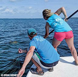
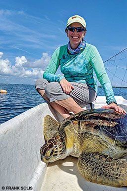
University of Central Florida researcher Kate Mansfield, an ICARUS participant, has monitored sea turtles in the Gulf of Mexico for years. She can currently tag turtles with shells as small as about 5 inches (13 centimeters) long. The ICARUS tags can be placed on turtles with shells as small as 3 inches (8 cm) long. Studies have shown that transmitters should weigh no more than 5 percent of the animal’s body weight to avoid affecting its behavior or chances of survival.
“In general, when putting something on an animal, you want to reduce its impact on the animal,” Mansfield said. “Reducing the size and weight of tracking tags helps do that. We’ll be able to tag post-hatchling turtles, maybe even those that are just a few weeks to a month old. Smaller animals haven’t been tracked for long distances, so these tags will expand our understanding of their movements.”
ICARUS plans to make all its data, except for sensitive conservation data, publicly accessible. Thanks to these space-based tools, scientists will soon learn more about life in the oceans on Earth.
© Alert Diver — Q1 2019