MAHS Trains Divers as Avocational Underwater Archaeologists
The day was somewhat deceiving. The sky was blue, and the summer sun was warm, but the rush of cold water filled our wetsuits and created a sudden chill as we submerged deeper into the muddy waters of the Pamunkey River in eastern Virginia.
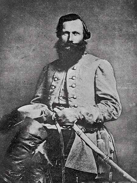
Our objective was to reconnoiter the riverbank for clues that might help us locate the remains of two schooners reported to have been burned and sunk on June 13, 1862, during Confederate Gen. J.E.B. Stuart’s famous cavalry ride around Union Gen. George McClellan’s army. This search wasn’t going to be easy; visibility was so poor that we could hardly see our own hands, much less locate shipwrecks that sank more than a century ago. We would have to do our work completely by feel.
Divers working in conditions like those in the Pamunkey River face difficult challenges. This diving is characterized by zero visibility, cold riverine water, varying currents, and lots of detritus — such as trees, tree limbs, and all kinds of trash picked up from the shoreline upstream — especially after a rainy period, when the river floods and clears anything loose from its banks.
Our dive safety officer has different guidelines for the team based on the conditions. On the day of this dive, the Maritime Archaeological and Historical Society (MAHS) team was dealing with the normal low visibility, cold water, and mild currents.
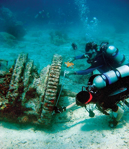
Low-visibility diving is like groping your way around a house in the dark, searching for a flashlight when the power goes out. You proceed cautiously, feeling your way through the murk with your hands outstretched to touch walls, furniture, and anything else that provides a sense of direction and bearing. Unlike at home, however, divers must also protect their head from potential impacts with floating trees, a ship’s hull, or anything else that could cause injury. It’s also important to avoid unintended overhead situations and snags that could prevent divers from moving freely or, worse, from surfacing.
Our dive team was made up entirely of MAHS members who had completed the MAHS Introduction to Underwater Archaeology course. This in-depth curriculum consists of nine classes covering the science and techniques of maritime archaeology and is designed specifically for recreational scuba divers. Experts in maritime archaeology present the classes, which include topics such as archival research, ship architecture, search methods, remote sensing, survey recording and mapping, photography and videography, law and ethics, conservation, project planning and reports, and a final review class conducted by John Seidel, PhD, former MAHS president.
We learned in the archival research class that we would conduct research before showing up at the river. We found a considerable historical record. Many sources described how Stuart and his cavalry of 1,200 men had established an excellent reputation with Confederate Gen. Robert E. Lee, commander of the Army of Northern Virginia. Lee selected Stuart and his men to conduct a secret movement to the rear of the Union Army advancing on Richmond. The objective was to gain critical intelligence about Union operations and confirm that their right flank remained unguarded and thus vulnerable to Confederate attack.
During this mission, Stuart encountered Union troops along the way but prevailed in the ensuing skirmishes. Stuart’s cavalry eventually arrived at Tunstall’s Station, where they fired on a supply train headed to White House Landing and burned several wagons, effectively scattering the Union’s 11th Pennsylvania Cavalry. That same day, they surprised teamsters along the road to Garlick’s Landing and burned two schooners loaded with supplies intended for Union troops.
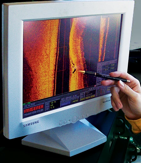
The MAHS team had previously partnered with Seidel to conduct a sonar survey of the Pamunkey River. As part of that effort, we located many wrecks and other anomalies, including the two at Garlick’s Landing. If MAHS could identify the wrecks as the ships Stuart burned during his raid, the sites would be an important historic resource related to the Civil War’s Peninsula Campaign and should be protected and preserved. But first we had to positively identify them, which is a real challenge given the currents, lack of visibility, and other dive conditions in the Pamunkey River.
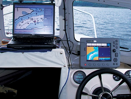
Our process for locating shipwrecks in low visibility and current varies with each situation. On our first dive, the team entered the water, cautiously searched, and then returned to report their findings. A sketch is made from all the diver reports, and it is often amusing to see the results, given the differences in individual reports. This chaotic reporting process is the first attempt to understand what is in the water and provides a starting point.
Once the wreck is located, MAHS switches to a modified semicircle search. This search method uses an established fixed point on the riverbank, with a line extended from that point into the water. The search follows a repeated semicircular pattern at varying line lengths on successive dives. The divers then report anything they find on each pass until they finally locate the hulls.
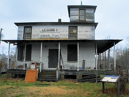
During the initial dives, we located the shipwrecks and thought we had found two schooner hulls side by side. One hull had tongue-and-groove floor planking, and the other had wide-board floor planking. The sector scan image shared by team member Bill Waldrop, however, indicated there were actually three wrecks at the site. The MAHS team therefore needed to revise the search plan to establish a baseline and map the shipwrecks to determine what we had found and how it related to the sector scan image.
Vessels are lost all the time, so one of the first questions archaeologists ask is whether any given wreck dates to the period and its meaningful events. A close examination of various forms of evidence helps answer that question.
The first step is correlating the documented evidence with the wreck itself. If historical sources indicate a specific vessel type, how does the structure we see on the bottom compare when considering dimensions such as length, beam, and form? We know schooners were among the vessels in the Union amphibious fleet, for example, and the shape in one of our sonar images seems consistent with that boat type.
Other factors include dating and function. A vessel sunk during the Civil War should exhibit construction methods prevalent in the mid-19th century, such as joinery, fastenings, hull sheathing, and layout. We can also date various components of the vessel, which is the sometimes-esoteric world of archaeology and material culture. Archaeologists have constructed chronologies for a remarkably wide range of artifacts, including fasteners, hull sheathing, rigging, ground tackle, munitions, and armament, as well as contents such as pottery, glass, buttons, and even food remains.
Drawing on these chronologies, if we find a glass bottle with a tooled finish and no evidence of a process called air venting in its production, it probably dates from the 1870s to about 1881 and should not be found inside a Civil War wreck. By contrast, construction techniques and contents that are consistent with the period, such as Civil War uniform buttons or Minié balls (invented in 1849), would strengthen the case that it is a wreck from the period of interest.
We can glean much of the information that will confirm a sunken ship’s date and function through careful observation, but artifacts pose a different question: Will we record them and leave them in place or retrieve them? That choice will be part of a decision tree embedded in the archaeological research design for a project.
If artifacts are recorded in place, a professional archaeologist must specify the types of documentation and information needed to assign a date or function. All MAHS projects have a qualified archaeologist as a team member. Retrieving materials opens a whole new set of decisions, including how to record their precise locations on the wreck, how to handle and preserve them to stop corrosion or degradation after exposure to air, and how to determine ownership and long-term curation.
Once we have pinpointed the vessels of interest, the next step is to record them using archaeological techniques, gathering evidence that will help identify and date them. We typically do this in stages, moving from general information to increasingly refined views. If possible, we produce a detailed site plan accurate down to individual fasteners, such as nails in deck planks and the trunnels used for frame fastening.
For the Pamunkey wrecks, our first step was establishing a baseline on each wreck from which to take measurements. We try to run the baseline down the vessel’s centerline, starting at either the stem or sternpost. Using GPS from the surface or conventional surveying methods lets us fix the ends of the baseline in the real world. Once we have a baseline, we can map and draw points on the wreck, starting with a general outline and using one of several techniques.
Using trilateration, for example, a dive team records measurements to a point from two different locations along the baseline. Each measurement describes an arc on the plan, and the mapped point lies at the intersection of the two arcs. This is a time-consuming but remarkably accurate approach. It becomes more difficult as the distances increase and visibility declines.
An alternative is to measure from the baseline to a point while making sure the measuring tape is at a true right angle to the baseline, a technique referred to as offsets. If the angle is truly 90 degrees, we can accurately map the point. Because this method requires less communication, it can be more efficient, but keeping the tape at a right angle and horizontal to ensure an accurate measurement can be challenging, especially in low visibility.
In some circumstances, measurements are recorded on the surface, with data that divers report using full-face masks wired for two-way communication. In extremely low visibility, divers can discern measurements on a measuring tape by moving it right up to their masks and using a headlamp.
As a check on the accuracy of these measurements, a sample of points is often verified using ground-based surveying or software that automates a process like the direct survey method, which uses multiple measurements from fixed points around the site to trilaterate in three dimensions. Archaeologists have developed a variety of techniques to ensure precision in their measurements, and MAHS divers are fully trained in these techniques.
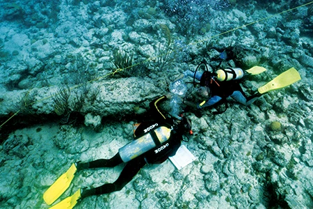
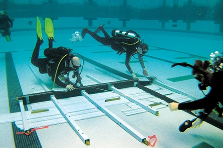
Incorporated in 1988, the MAHS has been conducting the Introduction to Underwater Archaeology course during the winter months for the past 38 years. The organization has been active in many field projects over the years, both locally and in various countries around the world. When divers earn the MAHS diploma and sign the organization’s Statement of Ethics, they have earned the right to be referred to as avocational underwater archaeologists and qualify to serve as productive members of an underwater archaeology team.
As avocational underwater archaeologists, MAHS divers forgo activities such as treasure hunting or collecting artifacts as trophies. Instead, they devote their volunteer diving to documenting and preserving shipwrecks. They assist professional archaeologists in mapping and surveying the wrecks and publishing their significance, thereby providing photographs and site plans of shipwrecks that the nondiving public might not otherwise see.
State underwater archaeologists in the U.S. are responsible for identifying historic shipwrecks within their jurisdictions and documenting them for future reference, but they rarely have enough staff to complete this work. This is where MAHS-trained volunteers add value by locating these shipwrecks and uncovering their history.
Throughout the years, MAHS has been devoted to including recreational sport divers in exploring historic shipwrecks and documenting maritime sites in accordance with U.S. and international shipwreck laws. The greatest impact of MAHS has been its education programs, which introduce recreational scuba divers to the science and techniques of maritime archaeology and prepare them to volunteer as members of underwater archaeology teams. The value of these programs has become evident in the growing community awareness of the importance of protecting and preserving historic shipwrecks and other submerged cultural resources.
The ethical standards MAHS brings to all projects and programs have made a substantial contribution to preserving fragile submerged cultural resources in the U.S. and elsewhere so they remain protected for future generations to explore and enjoy.
Explore More
Pamunkey River, Virginia: Dive Every Puddle
MAHS: Intro to Underwater Archaeology
© Alert Diver – Q4 2026